
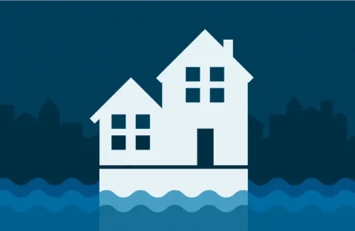
All About Elevation Certificates
Elevation Certificates (ECs) show if your client’s property meets local floodplain management ordinances. If it does, they may qualify to pay less for flood insurance.

Why are ECs important?
If your client’s building is in a high-risk flood area, an EC can help. It provides information that can guide actions to lower flood risk and ensures properties follow local floodplain management ordinances.
ECs show where the building is, the height of its lowest floor compared to the Base Flood Level (BFE) and other details about the building and its flood zone.

Are ECs needed for buying flood insurance?
An EC is not required to purchase coverage under the National Flood Insurance Program's (NFIP) pricing methodology. Instead, one of the factors FEMA uses to calculate rates, is the First Floor Height of a building.
Property owners can choose to submit an EC to their agent to see if it will lower their insurance costs. And, because ECs are still used for floodplain management building requirements, they can affect eligibility for Community Rating System (CRS) discounts.

Encourage clients to learn more
ECs help guide actions that can lower flood risk.
ECs are also used for floodplain building requirements and can affect eligibility for discounts through the CRS.
Encourage your clients to learn about ECs and how they can help reduce their risk and maybe lower their insurance costs.
Agent Training
Elevation Certificate FAQs
As an insurance agent for the NFIP, it is your responsibility to help your clients understand and use ECs. Review the Elevation Certificate Fact Sheet for more information.
These questions can help you guide your client’s decision-making process. For additional assistance, contact your underwriting department or visit the Map Update web pages.
An EC is a tool used by the National Flood Insurance Program (NFIP) to provide elevation information necessary to ensure buildings meet community floodplain management ordinances. It also helps lower flood risk and support a request for a Letter of Map Amendment (LOMA) to remove a building from a high-risk flood area.
The EC lists a building’s location, lowest point of elevation and flood zone among other characteristics.
Under the NFIP's pricing approach, ECs are no longer required to purchase coverage. Instead, FEMA uses tools to determine the First Floor Height as one of the factors used when calculating rates.
Under NFIP's pricing approach, property owners may choose to provide an EC and submit it to their agent to see if it will lower their insurance cost. ECs are still used for floodplain management building requirements and can affect eligibility for CRS discounts.
If your client obtains an EC, review their rate annually using the certificate. This is critical because insurance agents are responsible for determining the best rate and coverage for their clients each year.
The first thing they should do is contact their local floodplain manager and find out if an EC is on file for their property.
If not, they can hire a land surveyor, engineer or architect to complete one. Floodplain managers often work with or in a community's local building, permitting, engineering or land use department.
Most homeowners do not need an EC to get flood insurance. The exception is if they live in high-risk (Zone A) or high-risk coastal (Zone V) flood area. Homeowners in these areas may need ECs to verify their properties meet local floodplain management ordinances.
ECs don't set insurance rates, but they can identify discounts. Even if your clients don't live in Zones A or V, it's worth checking to see if their property has an EC on file.
Basements do not factor into a property’s First Floor Height. Basements are measured separately because they are below ground.
Basements are an indicator of flood risk, and if a building has one, it will be noted on the EC.